Understanding the House Listing & Housing Census 2027
Before India counts its population in Census 2027, another important exercise takes place—the House Listing and Housing Census.
During this phase, census officials visit every street, neighbourhood, and village to record every building and household. It may seem like a simple door-to-door survey, but it forms the foundation of the entire census.
Without an accurate list of houses, it would be impossible to count the population correctly.
Geographer’s Note
A census is not simply a count of people—it is a map of how a city lives, grows, and changes over time.
What is the House Listing and Housing Census?
The House Listing and Housing Census is the first stage of Census 2027.
Instead of counting people, it records information about buildings, houses, and basic household facilities. Officials collect details such as the type of housing, access to drinking water, electricity, sanitation, cooking fuel, and other essential amenities.
Each building is assigned a unique number to be identified during the Population Census.
Why is it Important?
The information collected is useful for much more than counting houses.
It helps governments understand how people live and whether different neighbourhoods have access to basic services. It also provides valuable information for planning roads, schools, hospitals, water supply, sanitation, and housing projects.
For geographers, this data helps explain how settlements grow and how cities change over time.
Reading Agra Through the Census
Every city has its own geographical character, and Agra is no exception.
The historic core of Agra is characterised by dense neighbourhoods and narrow streets, while the city’s outskirts continue to witness the growth of new residential colonies. Along the Yamuna River, settlement patterns have evolved differently from those in the western and southern parts of the city. At the same time, tourism, migration, industry, and rapid urbanisation continue to reshape the city’s landscape.
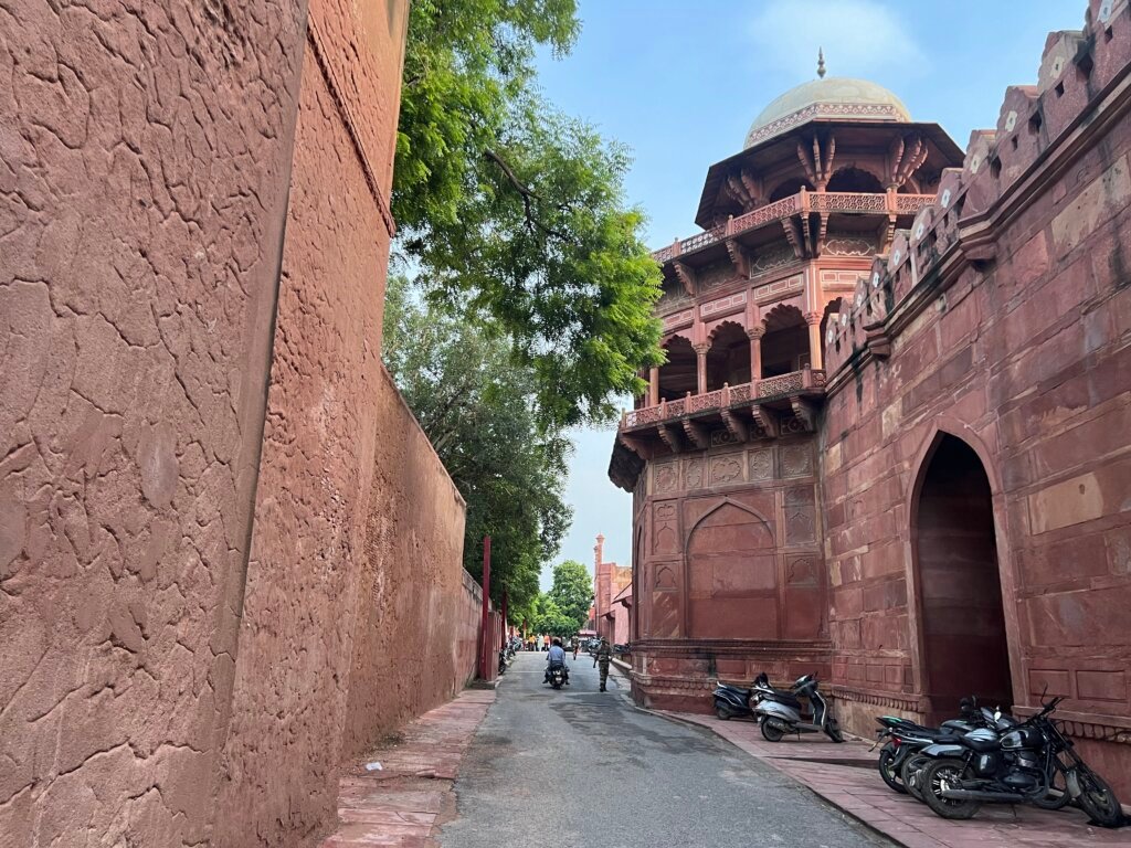
These differences make the House Listing and Housing Census much more than an administrative exercise. It records how people occupy space, how neighbourhoods are changing, and where essential services are needed. For geographers, it provides valuable evidence for understanding urban growth, settlement patterns, and the relationship between people and place.
How is the Survey Conducted?
Enumeration Block
Each Enumeration Block usually covers about 120–150 households.
Assigned Enumerator
One trained enumerator is assigned to a clearly defined area.
Door-to-Door Visit
Houses, shops, vacant units and institutions are visited and listed.
House Numbering
Every structure receives a unique number for accurate census coverage.
Housing Details
Water, electricity, sanitation, rooms, cooking fuel and ownership are recorded.
Digital Entry
Information is entered digitally for faster and more accurate processing.
Verification
Supervisors verify records to reduce errors and avoid missed households.
Final Upload
Verified data is uploaded and becomes the base for Census 2027.
Challenges in the Field
Although the process is well organised, conducting a census in a city like Agra is far from straightforward.
Enumerators often work through the narrow lanes of the old city, densely populated neighbourhoods, informal settlements, and newly developed residential colonies. In many cases, several households may occupy a single building, requiring careful verification to ensure that each family is counted separately.
Field officials also encounter locked houses, temporarily absent residents, and migrant workers whose place of residence may change frequently. During the summer months, temperatures in Agra often exceed 45°C, making long hours of door-to-door surveys physically demanding.
Despite these challenges, the objective remains the same: to ensure that every building and every household is included, leaving no part of the city unrecorded.
A Day in the Field
Following the survey route of a Census Enumerator
Fieldwork Begins
The day starts early to avoid Agra’s intense afternoon heat.
Old Agra
Narrow lanes and closely packed houses require careful listing.
Locked House
Repeat visits ensure that no household is missed.
Multiple Households
One building may contain several independent families.
Informal Settlement
Dense and changing settlements need careful verification.
Survey Complete
Collected information is reviewed and uploaded digitally.
Geography in Action: Mapping Enumeration Blocks for Census 2027
The House Listing and Housing Census depends on accurate maps. Every enumerator must know the exact boundaries of the House Listing Block (HLB) assigned to them before fieldwork begins. Even a small error can result in houses being omitted or counted twice.
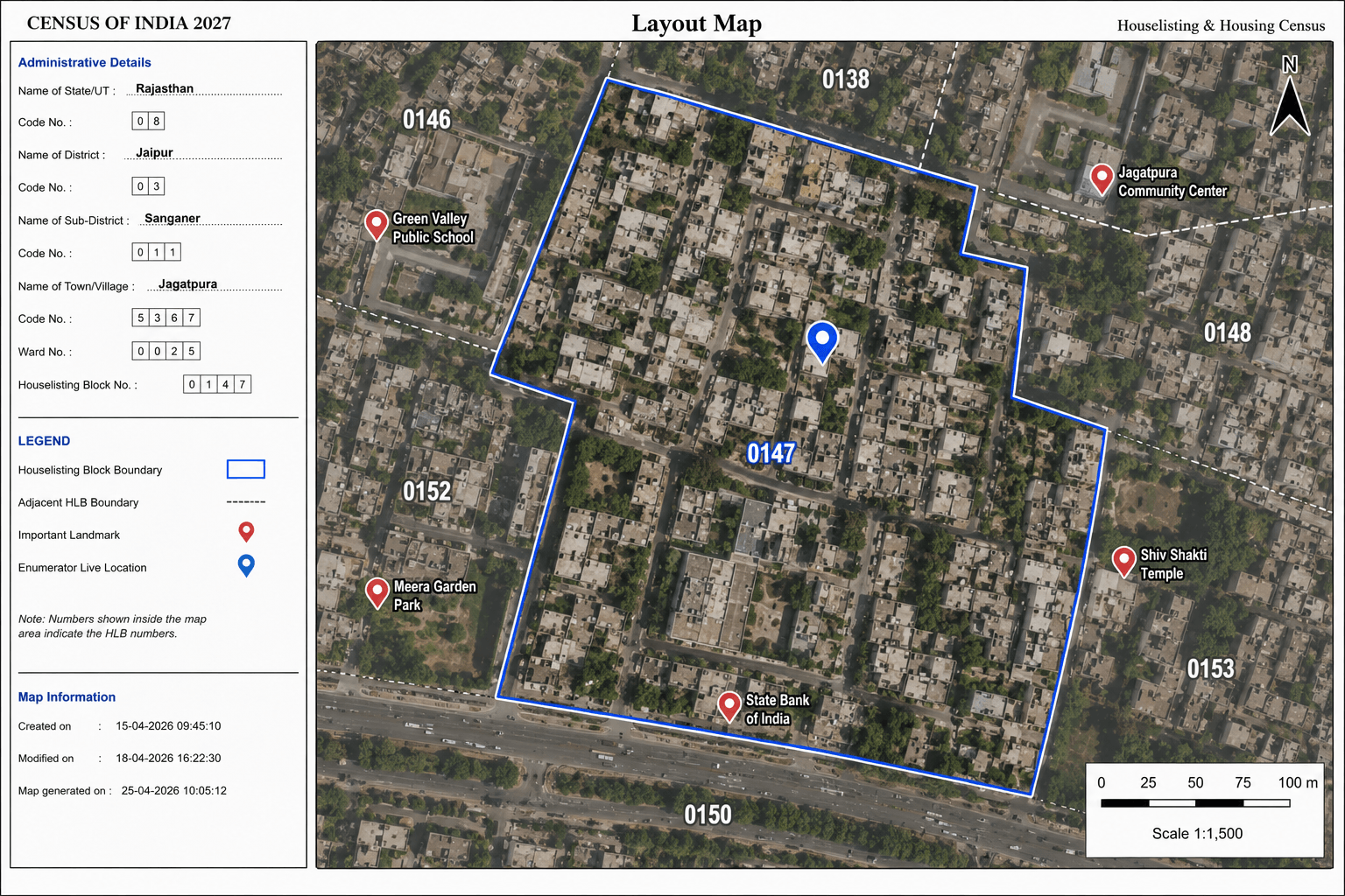
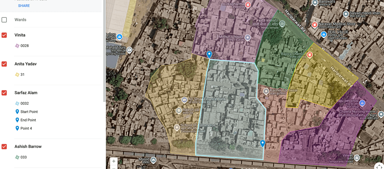
Recognising this challenge, the Department of Geography, St. John’s College, Agra, took a special initiative to support the census exercise by developing interactive digital maps for the Enumeration Blocks assigned to student enumerators. The original HLB layout maps were transformed into easy-to-use web-based maps that could be accessed directly on a mobile phone during fieldwork.
Unlike conventional printed maps, these interactive maps display the HLB boundary over high-resolution satellite imagery and include the enumerator’s live GPS location. This enables field officials to confirm whether they are within the correct Enumeration Block, navigate narrow streets more confidently, and identify the exact limits of their assigned area.
Readers can explore these maps through The Meridian Society’s dedicated Census Mapping Portal:
The project demonstrates how geographical knowledge, GIS, and digital mapping can contribute directly to public administration. It also highlights the growing role of geographers in applying spatial technologies to solve practical problems beyond the classroom.
Beyond the Numbers
As Census 2027 progresses, millions of buildings and households across India will become part of one of the world’s largest statistical exercises. Yet behind every entry in the census database lies a home, a family, and a unique story.
For Agra, the House Listing and Housing Census provides much more than a record of buildings. It captures the city’s changing urban landscape—from the historic lanes of the old city and expanding residential colonies to informal settlements and newly developing neighbourhoods. The information collected today will support better planning, improved public services, and more informed decisions for years to come.
The dedication of census officials, supported by modern digital technologies and geographical tools, ensures that every building and every household is included, leaving no part of the city unrecorded.
The House Listing and Housing Census reminds us that geography is not only about maps. It is about understanding places, people, and the changing relationship between them.

Discover more from The Meridian Society
Subscribe to get the latest posts sent to your email.